
Mayflower Lake Resort - East Cabin
Hiking, Biking and Sight Seeing
“The Dells of the Eau Claire River protects a scenic, narrow rocky gorge and waterfalls where geologic processes have resulted in an unusual tilting of bedrock. On this picturesque stretch of the Eau Claire River, the river cascades over outcrops of Precambrian-age rhyolite schist. The rhyolite schist, a very hard rock, was formed through metamorphosis and later tilted here to a nearly vertical position allowing the rock to split readily along the cleavage planes. In the dells, the river tumbles and spills across the rock’s cleavage planes while it runs smoothly in other areas where the river flows parallel to the planes. The water current through the dells has been strong enough to produce a series of potholes, formed by the grinding action of swirling sand and gravel. Downstream the flow is quite tranquil. This is an excellent area to observe fracture controlled stream flow and the development of multiple stream terraces. The rocky gorge and forested areas are wooded with a northern mesic forest of hemlock, sugar maple, yellow birch, and mountain maple. The central portion of the SNA contains a vein that is dominated by hemlock that survived the cut-over with trees aged between 181 and 249 years. Other Northern Hardwood species within this area are quite large in diameter and likely older as well. Canada yew is abundant in dense patches and the spring flora is rich. The Dells of the Eau Claire is owned by Marathon County and was designated a State Natural Area in 1973.” dnr.wi.gov/topic/Lands/naturalareas
16 локални жители го препорачуваат
Dells of the Eau Claire Park
County Road Y“The Dells of the Eau Claire River protects a scenic, narrow rocky gorge and waterfalls where geologic processes have resulted in an unusual tilting of bedrock. On this picturesque stretch of the Eau Claire River, the river cascades over outcrops of Precambrian-age rhyolite schist. The rhyolite schist, a very hard rock, was formed through metamorphosis and later tilted here to a nearly vertical position allowing the rock to split readily along the cleavage planes. In the dells, the river tumbles and spills across the rock’s cleavage planes while it runs smoothly in other areas where the river flows parallel to the planes. The water current through the dells has been strong enough to produce a series of potholes, formed by the grinding action of swirling sand and gravel. Downstream the flow is quite tranquil. This is an excellent area to observe fracture controlled stream flow and the development of multiple stream terraces. The rocky gorge and forested areas are wooded with a northern mesic forest of hemlock, sugar maple, yellow birch, and mountain maple. The central portion of the SNA contains a vein that is dominated by hemlock that survived the cut-over with trees aged between 181 and 249 years. Other Northern Hardwood species within this area are quite large in diameter and likely older as well. Canada yew is abundant in dense patches and the spring flora is rich. The Dells of the Eau Claire is owned by Marathon County and was designated a State Natural Area in 1973.” dnr.wi.gov/topic/Lands/naturalareas
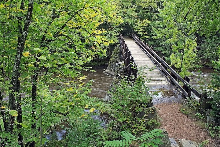
“The Ice Age Trail is a National Scenic Trail located entirely within Wisconsin. The trail is also one of 42 designated Wisconsin state trails and the only one specifically designated as a "State Scenic Trail." From Interstate State Park on the Minnesota border to Potawatomi State Park on Lake Michigan, the Ice Age Trail winds for more than 1,000 miles, following the edge of the last continental glacier in Wisconsin.
One of only 11 National Scenic Trails, the Ice Age Trail is intended to be a premier hiking trail and conservation resource for silent sport and outdoor enthusiasts. The trail traverses some of Wisconsin’s most scenic landscapes and helps tell the story of the last Ice Age by highlighting Wisconsin's unique glacial features.” dnr.wisconsin.gov/topic/parks/iceagetrail
There are various access points, including near Hatley and The Delles of the Eau Claire. Trail maps can be found on Ice Age Trail website.
Ice Age Trail Dells Segment Trailhead
175284 County Road Z“The Ice Age Trail is a National Scenic Trail located entirely within Wisconsin. The trail is also one of 42 designated Wisconsin state trails and the only one specifically designated as a "State Scenic Trail." From Interstate State Park on the Minnesota border to Potawatomi State Park on Lake Michigan, the Ice Age Trail winds for more than 1,000 miles, following the edge of the last continental glacier in Wisconsin.
One of only 11 National Scenic Trails, the Ice Age Trail is intended to be a premier hiking trail and conservation resource for silent sport and outdoor enthusiasts. The trail traverses some of Wisconsin’s most scenic landscapes and helps tell the story of the last Ice Age by highlighting Wisconsin's unique glacial features.” dnr.wisconsin.gov/topic/parks/iceagetrail
There are various access points, including near Hatley and The Delles of the Eau Claire. Trail maps can be found on Ice Age Trail website.
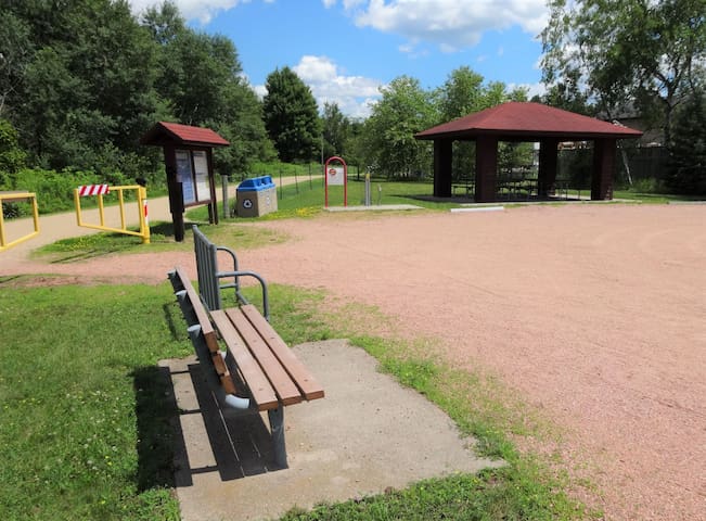
“The Mountain-Bay State Trail is one of the longest rail-trails in Wisconsin. The trail travels for 83 miles between the two geologic features it is named for; Rib Mountain and Green Bay. On the western end, the trail ends in Weston, just east of Wausau. On the eastern end, the trail ends at Howard Memorial Park near the city of Green Bay. There is a short gap in the trail in the city of Shawano near the Wolf River where local roads are used to connect the trail.” https://dnr.wisconsin.gov/topic/parks/mountainbay
There are various access points. The closest is only 2 miles away. South on Hwy D, Right on Norrie Road. There is a parking and picnic area on the north shore of Norrie Lake.
Mountain-Bay State Trail
Mountain-Bay State Trail“The Mountain-Bay State Trail is one of the longest rail-trails in Wisconsin. The trail travels for 83 miles between the two geologic features it is named for; Rib Mountain and Green Bay. On the western end, the trail ends in Weston, just east of Wausau. On the eastern end, the trail ends at Howard Memorial Park near the city of Green Bay. There is a short gap in the trail in the city of Shawano near the Wolf River where local roads are used to connect the trail.” https://dnr.wisconsin.gov/topic/parks/mountainbay
There are various access points. The closest is only 2 miles away. South on Hwy D, Right on Norrie Road. There is a parking and picnic area on the north shore of Norrie Lake.
“This billion-year-old hill is one of the oldest geological formations on earth. Rib Mountain State Park is a premier day-use property with picnicking, hiking trails and reservable facilities that include a scenic amphitheater, indoor gathering space and picnic shelters. The top of the park offers spectacular views of the Wausau area and Wisconsin River. Granite Peak Ski Area is on the north face of the mountain and offers downhill skiing and snowboarding.” dnr.wisconsin.gov/topic/parks/ribmt
29 локални жители го препорачуваат
Државен парк Риб Маунтин
149801 Park Rd“This billion-year-old hill is one of the oldest geological formations on earth. Rib Mountain State Park is a premier day-use property with picnicking, hiking trails and reservable facilities that include a scenic amphitheater, indoor gathering space and picnic shelters. The top of the park offers spectacular views of the Wausau area and Wisconsin River. Granite Peak Ski Area is on the north face of the mountain and offers downhill skiing and snowboarding.” dnr.wisconsin.gov/topic/parks/ribmt
Skiing and Hiking
“Carve your path on the best hill in Wisconsin. Find your legendary adventure at Wisconsin’s #1 ski area, Granite Peak. Explore over 200 acres of terrain spread out across 60 trails serviced by the Midwest’s fastest lift system, including the only 6-pack in Wisconsin! Cruise down a groomer, explore our expansive woods, or take a ride through the air on one of four progressive terrain parks. When you need a break, relive your turns over a hot chocolate or cold beer next to one of our fire pits on the newly transformed Historic Chalet Deck. Be Legendary at Granite Peak.” skigranitepeak.com
Off season activities are available as well.
45 локални жители го препорачуваат
Гранит Пик Ски Арија
227200 Snowbird Ave“Carve your path on the best hill in Wisconsin. Find your legendary adventure at Wisconsin’s #1 ski area, Granite Peak. Explore over 200 acres of terrain spread out across 60 trails serviced by the Midwest’s fastest lift system, including the only 6-pack in Wisconsin! Cruise down a groomer, explore our expansive woods, or take a ride through the air on one of four progressive terrain parks. When you need a break, relive your turns over a hot chocolate or cold beer next to one of our fire pits on the newly transformed Historic Chalet Deck. Be Legendary at Granite Peak.” skigranitepeak.com
Off season activities are available as well.
"Nine Mile Forest is one of the top cross-country skiing facilities in Wisconsin.
The 18.3 mile (29.6km) trail system is double tracked with an 8′ wide skating lane. Trail difficulty ranges from beginner to difficult making this trail system attractive to all skiing abilities. Trails are generally one-way. The ski chalet offers a changing area, ski and snowshoe equipment rentals, daily and annual trail passes, restrooms, and a spacious warming area with a wood stove. There are 3.9 miles (6.3km) of ski trails lighted and programmed to go on at dusk until 9 pm daily during the ski season. There are also 5.3 miles (8km) of groomed snowshoe trails throughout the forest." www.wausaunordic.org/nine-mile-forest/
17 локални жители го препорачуваат
Nine Mile Forest Cross-Country Skiing and Snowshoeing
221700 Red Bud Rd"Nine Mile Forest is one of the top cross-country skiing facilities in Wisconsin.
The 18.3 mile (29.6km) trail system is double tracked with an 8′ wide skating lane. Trail difficulty ranges from beginner to difficult making this trail system attractive to all skiing abilities. Trails are generally one-way. The ski chalet offers a changing area, ski and snowshoe equipment rentals, daily and annual trail passes, restrooms, and a spacious warming area with a wood stove. There are 3.9 miles (6.3km) of ski trails lighted and programmed to go on at dusk until 9 pm daily during the ski season. There are also 5.3 miles (8km) of groomed snowshoe trails throughout the forest." www.wausaunordic.org/nine-mile-forest/
Local Restaurants
Chet & Emil's Restaurant
388 Main StFamous for broasted chicken
Subway
101 Jones Avenue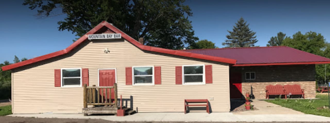
Mountain Bay Bar & Grill
Mill StreetTypical bar food and a fish fry!
Old-Fashioned Ice Cream Stands
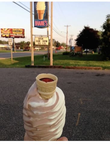
Diane's Soft Serve
415 U.S. 45Great ice cream menu plus burgers and fries
Frosty Freeze
101 Jones AvenueFull soft-serve and hard scoop ice cream menu
Casinos
Ho-Chunk Gaming Wittenberg
N7198 US-45Golfing
Maple Hills Golf Course
N6621 Cardinal Lane9 hole golf course and restaurant; call ahead to check grill hours

Greenwood Hills Country Club
2002 Poplar Lane9 holes and restaurant; open to the public
Young Kids
154 US hwy 45 in Birnamwood - Summer vegetable market stand
194 Western Avenue, Birnamwood - Sunflower fields and picture opportunities - late August/Early September and fall corn maze and petting zoo mid September through late October.
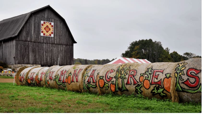
Schairer's Autumn Acres & Greenhouse LLC
194 Western Avenue154 US hwy 45 in Birnamwood - Summer vegetable market stand
194 Western Avenue, Birnamwood - Sunflower fields and picture opportunities - late August/Early September and fall corn maze and petting zoo mid September through late October.